NOTE Effective January 31, 2026, ARD will no longer be available as an API programmatic ordering option for imagery through our platform. See the deprecation notice.
Visual Image
Overview
The visual format converts the source imagery to an 8-bit range suitable for visual display.
Images from multiband sensors (Worldview 2, 3, and 4) are:
- Orthorectified
- Pansharpened using panchromatic and multiband images
- Red-Green-Blue bands only
- Radiometrically balanced per tile
- Dynamic range adjusted to 8-bits per band (RGB)
- Resampled to 0.30517578125m pixel size and aligned to the ARD grid
Images acquired by Worldview 1 are only panchromatic so they are:
- Radiometrically balanced per tile
- Dynamic range adjusted to 8-bit (greyscale)
- Resampled to 0.30517578125m pixel size and aligned to the ARD grid
Files are delivered as Cloud Optimized GeoTIFF (COG):
- processed using GDAL's
COGoutput format using default settings - RGB images use
JPEGYCbCr compression - Panchromatic images use
DEFLATEcompression - NoData pixels are encoded in a mask band
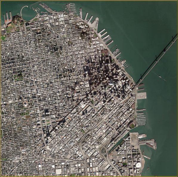
Example image
This example shows a "visual" pan-sharpened image over San Francisco, CA USA.
Bands
Visual RGB imagery has the following three bands:
| band name | common name | description |
|---|---|---|
| BAND_R | red | Red |
| BAND_G | green | Green |
| BAND_B | blue | Blue |
Panchromatic visual imagery has one band:
| band name | description |
|---|---|
| BAND_P_V | Pan Visual |
File information
File type: Raster GeoTIFF
File name: {acquisitionID}-visual.tif
File path: bucket or location/prefix/UTM zone/quadkey/acquisition date/