Intro to Vector Analytics
Overview
Use the Vector Analytics API to stream Change Monitoring (CM) layers using Open Geospatial Consortium (OGC) standard requests. CM Electro-optical (EO) and synthetic aperture radar (SAR) layers are available by year.
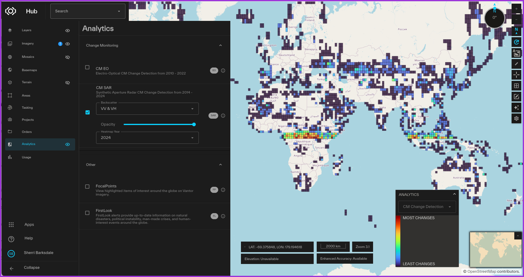 Change Monitoring polygons displayed in the Vantor Hub User Interface.
Change Monitoring layers
Change Monitoring layers are named by the type of change monitoring and the year the layer was created.
Change Monitoring types
| CM Type | Description | Example layer name |
|---|---|---|
| PCM-SAR | Synthetic Aperture Radar change monitoring | Maxar:layer_pcm_sar_2022 |
| PCM-EO | Electro-Optical change monitoring | Maxar:layer_pcm_eo_2020 |
These layers can also be viewed in the Vantor Hub User Interface, and more detailed descriptions can be found in the Vantor Hub UI Documentation.
Authentication
All OGC services accept an API key or a bearer token for authentication.
Bearer tokens
Oauth bearer tokens can also be used to authenticate API requests. Bearer tokens have a brief duration and must be refreshed frequently.
To authenticate with a bearer token, use the Authorization header:
Authorization: Bearer <Oauth2 token>
Learn about OAuth2 bearer tokens
API keys
API keys can be passed using query parameters or in a custom header. No Authorization header is needed when using API keys.
To use the query parameter method, include this query parameter in your request:
maxar_api_key=<your API key>
The custom header takes the form of:
maxar-api-key: <your API key>
API keys expire 180 days from creation by default. A custom expiration date can be set but cannot exceed 180 days.
Learn about API keys
Web Feature Service (WFS)
| Name | Description | Request URL |
|---|---|---|
| Get Capabilities | Returns supported capabilities and layers. | https://api.maxar.com/analytics/v1/vector/change-detection/Maxar/ows?Service=WFS&Request=GetCapabilities |
| Describe Feature Type | Returns the properties available for a supported feature type. | https://api.maxar.com/analytics/v1/vector/change-detection/Maxar/ows?service=wfs&request=DescribeFeatureType&version=2.0.0 |
| GetFeature | Returns information about the features within a CM layer. | https://api.maxar.com/analytics/v1/vector/change-detection/Maxar/ows?SERVICE=WFS&REQUEST=GetFeature&VERSION=1.0.0&TYPENAMES=Maxar:{layer name goes here} |
WFS Get Capabilities
WFS GET Capabilities returns information about the service and the CM layers.
Request Example:
https://api.maxar.com/analytics/v1/vector/change-detection/Maxar/ows?service=wfs&version=1.3.0&request=GetCapabilities
Query parameters
| Name | Description | Value |
|---|---|---|
| service | The name of the OGC service the request will be sent to. | WFS |
| version | The service version. Use the latest version. | 1.3.0 |
| request | Request type | Get Capabilities |
WFS Describe Feature Type
WFS Describe Feature Type returns the metadata associated with the feature type. Feature type names are the same as the CM layer names.
For example:
Maxar:layer_pcm_eo_2020
Maxar:layer_pcm_sar_2022
Request example:
https://api.maxar.com/analytics/v1/vector/change-detection/Maxar/ows?service=wfs&request=DescribeFeatureType&version=2.0.0
Query parameters
| Name | Description | Value |
|---|---|---|
| service | The name of the OGC service the request will be sent to. | WFS |
| version | The service version. Use the latest version. | 2.0.0 |
| request | Request type | DescribeFeatureType |
WFS Get Feature
WFS Get Feature returns the features within the requested bounding box for the specified layer. The response will include the geometry and metadata for each feature.
Request example:
https://api.maxar.com/analytics/v1/vector/change-detection/Maxar/ows?service=WFS&request=GetFeature&version=1.0.0&typenames=Maxar:layer_pcm_eo_2020&bbox=6130096.703381219,2875149.1017800854,6187712.6957734255,2916336.2835501307,EPSG:3857&count=1&outputFormat=application/json
Query parameters
| Name | Description | Value |
|---|---|---|
| Service | The name of the OGC service the request will be sent to. | WFS |
| Version | The service version. Use the latest version. | 1.0.0 |
| Request | Request type. | GetFeature |
| TYPENAMES | The layer name. | Example: Maxar:layer_pcm_eo_2020 |
| COUNT | The number of features to return in the results set | Example: 25 |
| outputFormat | The requested format for the results set. Make a Get Capabilities request to see supported formats. | Ex. application/json |
| BBox | The bounding box geometry for the change area. | See request example above. |
Web Map Service (WMS)
The Vector Analytics API supports the following WMS request types:
| Name | Description | Request URL |
|---|---|---|
| Get Capabilities | Returns supported capabilities and layers. | https://api.maxar.com/analytics/v1/vector/change-detection/Maxar/ows?service=wms&version=1.3.0&request=GetCapabilities |
| Get Map | Returns change polygons for a bounding box that can be displayed in a browser application. | https://api.maxar.com/analytics/v1/vector/change-detection/Maxar/ows?Service=WMS&Request=GetMap&version=1.3.0&bbox=-11712956.404248431,4851060.1776836105,-11693388.525007427,4870628.056924616&crs=EPSG:3857&layers=Maxar:layer_pcmi_2011&height=512&width=512&format=image/vnd.jpeg-png |
WMS Get Capabilities
WMS GET Capabilities returns information about the service and the CM layers.
Request Example:
https://api.maxar.com/analytics/v1/vector/change-detection/Maxar/ows?service=wms&version=1.3.0&request=GetCapabilities
Query parameters
| Name | Description | Value |
|---|---|---|
| service | The name of the OGC service the request will be sent to. | WMS |
| version | The service version. Use the latest version. | 1.3.0 |
| request | Request type | Get Capabilities |
WMS Get Map
A WMS Get Map request returns change polygons for a bounding box that can be displayed in a browser application.
Request example:
https://api.maxar.com/analytics/v1/vector/change-detection/Maxar/ows?service=wms&request=GetMap&version=1.3.0&bbox=-11712956.404248431,4851060.1776836105,-11693388.525007427,4870628.056924616&crs=EPSG:3857&layers=Maxar:layer_pcm_eo_2010&height=512&width=512&format=image/vnd.jpeg-png&id=layer_pcm_eo_2020.fid-71409f07_1936f0f1de7_-623b
Query parameters
| Name | Description | Value |
|---|---|---|
| service | The name of the OGC service the request will be sent to. | WMS |
| version | The service version. Use the latest version. | 1.3.0 |
| request | Request type | GetMap |
| layers | The layer name | Example: Maxar:layer_pcm_eo_2020 |
| bbox | The bounding box geometry for the change area. | See request example above. |
| crs | The requested coordinate reference system (crs). Make a WMS Get Capabilities request to see supported projections. | Ex. EPSG:3857 |
| format | The requested format for the results set. Make a Get Capabilities request to see supported formats. | Ex. image/vnd.jpeg-png |
| height | The requested map image height. | Ex. 512 |
| width | The requested mag image width. | Ex. 512 |
Web Map Tile Service (WMTS)
The Vector Analytics API supports the following WMTS request types:
| Name | Description | Request URL |
|---|---|---|
| Get Capabilities | Returns supported capabilities and layers. | https://api.maxar.com/analytics/v1/vector/change-detection/Maxar/gwc/service/wmts?service=wmts&request=GetCapabilities&version=1.0.0 |
| Get Tile | Returns change polygons for the specified tile column, tile row, and tile matrix. | https://api.maxar.com/analytics/v1/vector/change-detection/Maxar/gwc/service/wmts?SERVICE=WMTS&REQUEST=GetTile&VERSION=1.0.0&LAYER=pcm_eo_2020&FORMAT=image/png&TILEMATRIXSET=EPSG:4326&TILEMATRIX=EPSG:4326:18&TILEROW=70575&TILECOL=127013 |
WMTS Get Capabilities
WMTS GET Capabilities returns information about the service and the CM layers.
Request Example:
https://api.maxar.com/analytics/v1/vector/change-detection/Maxar/gwc/service/wmts?SERVICE=WMTS&REQUEST=GetCapabilities&VERSION=1.0.0
Query parameters
| Name | Description | Value |
|---|---|---|
| Service | The name of the OGC service the request will be sent to. | WMTS |
| Version | The service version. Use the latest version. | 1.0.0 |
| Request | Request type | Get Capabilities |
WMTS Get Tile
A WMTS Get Tile request returns change polygons for the specified tile column, tile row, and tile matrix.
Request example:
https://api.maxar.com/analytics/v1/vector/change-detection/Maxar/gwc/service/wmts?SERVICE=WMTS&REQUEST=GetTile&VERSION=1.0.0&LAYER=pcm_eo_2020&FORMAT=image/png&TILEMATRIXSET=EPSG:4326&TILEMATRIX=EPSG:4326:18&TILEROW=70575&TILECOL=127013
Query parameters
| Name | Description | Value |
|---|---|---|
| Service | The name of the OGC service the request will be sent to. | WMTS |
| Version | The service version. Use the latest version. | 1.0.0 |
| Request | Request type | GetTile |
| layer | The layer name | Example: Maxar:layer_pcm_eo_2020 |
| tileMatrixSet | required | A pre-defined set of tiles for the spatial reference system. See supported tile matrix sets |
| tileMatrix | required | The tile matrix set and zoom level, from 0 (lowest) to 21 (highest). |
| tileCol | required | The column index of a tile matrix. |
| tileRow | required | The row index of a tile matrix. |
| format | optional | The output file format of the response. See Supported Output Formats. |
Supported tile matrix sets
Supported tile matrix sets
 EPSG:3857
 EPSG:3857x2
 EPSG:4326
 EPSG:4326x2
 EPSG:900913
 EPSG:900913x2
Supported output formats
By default, a map tile is returned in PNG format. The JPEG format will return the fastest service response. PNG is required for tiles with transparent backgrounds.
Supported output formats
image/png
image/jpeg